Monday, October 31, 2011

From models to forecasts and what humans add in-between (part 3)


(continued from part 1 and 2... these posts discuss some of what humans do when creating a river forecast. The previous posts talked about how forecasters would use models and then figure out what other information is useful)

By this stage, I, the forecaster, would have a mental image of what I “really think” the future might be. The next question is then “Is there some other information I could include to make this forecast more useful?” People love to hear analogues, such as “This flood is going to be like the one in 2009”. It helps put the forecast in context… In 2009, the flood came up to the top of the doorway on the first floor and stayed that way for about six hours before dropping. Therefore, I should move my valuables to the second floor and pack a day’s worth of food. As Mark Twain said, though “History does not repeat itself, but it does rhyme”. Therefore, while analogues are useful, they have limitations. 

This supporting information mentioned above helps people put the forecast in context, but it can also build trust in the forecast. Nearly all weather forecasts can be linked somehow to a “briefing discussion”. This can be a few non-technical words about the weather situation, or it can be a full-blown jargon and acronym filled discussion of the thought process that went into the forecasts. Strangely, such written discussion is commonly in all capitals and might read like “FOR SON THROUGH FMA WE USED CCA - OCN - TRENDS AND COMPOSITES. THE WEIGHT OF THE LA NINA COMPOSITES WAS GREATLY REDUCED FOR FMA AND MAM - ESPECIALLY FOR PRECIPITATION - AND WAS NOT USED THEREAFTER.”

Armed with this kind of information, the user can decide if he accepts the forecaster’s rationale. Perhaps more importantly he can decide if the forecast could be improved by adding extra information. For example, if I was a user in Manila, I would be thinking that the previous typhoon saturated the soils and so the next Typhoon is going to produce a lot of water. Do the forecasts already have that built in? Would nudging up the official forecasts be double-dipping? That kind of thing happened to me as a forecaster, but in the opposite direction. My first year of forecasting was the year after an epic drought and the soils were parched. My models didn’t have that built in and so I lowered the forecasts from what they would be otherwise. Then the people that were delivering the forecasts were recommending to users something to the effect of, “the official forecast is this, but we don’t know just how big the soil moisture effect is going to be, so you might consider preparing for an even lower number”.

There is much less of a tradition of such written “thinking out loud” briefing discussions by hydrologists than there is among weather forecasters. Personally I feel that hydrologists should be more transparent about their human adjustments to the final products. In my experience, however, this does not happen, not because the forecasters have anything to hide, it’s just something that they don’t have time for (or at least the forecast documentation process is not currently streamlined enough to make it practical).  

The final question is “Could a tweak to the forecast result in people making a better decision?” This is the most controversial question of all and there is a very wide range of opinions in the forecasting community about this. The ultimate goal of nearly all forecasting is to have a positive effect on people’s decisions. However, distorting or exaggerating a forecast to catch people’s attention is a major risk.

In his seminal paper on “what is a good forecast?” Alan Murphy said that a good forecast is one that is identical to the forecaster’s internal belief. In other words, if anyone was to say “yeah, that’s the official forecast, but what do you really think is going to happen?” the best answer is “there’s no difference”. Murphy’s context was in coming up with a score to say how good forecasts were and how there shouldn’t be any way that the hydrologist could “game” the forecasts to get a better score. For example, if you were scored on how often you “cried wolf”, you could get a perfect score by always keeping your mouth shut, even if a pack of wolves were in the process of viciously devouring you.

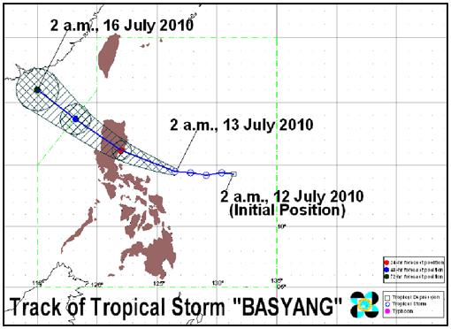
Consider the case of Manila though. What would I do if I were in a situation where a direct hit to a major metropolitan city would be catastrophic, but the rainfall forecast was for it to be a near-miss?… And last year a similar situation lead to a forecast bust and someone like me was demoted? What would I be thinking? Would I be tempted to nudge the model output up a bit in forecasts for major cities, just because the potential for loss was so great?  What if I thought people payed attention only when the forecasts were very high? What if, in my heart-of-hearts I didn’t think the river would get to the critical level, but I would feel consumed with guilt and regret if it did get that high?

A seasoned hydrologist once told me that there is a “big, big difference between flood forecasting and flood warning”. In essence, forecasting is trying to get the numbers right, warning is trying to make a difference in people’s lives.

Saint Thomas Aquinas also has a (paraphrased) quote that throughout our lives we shout our message out to the hillside. We cannot know how it echoes around in each valley or how it sounds to whatever listeners are out there. Similarly, if I was to nudge the forecast towards Manila, I would be nudging it away from those in the true likely path. What about them? Shouldn’t they also be warned? There are costs to over-preparing and we’re talking about real money here. Worse yet, what if I nudged the forecast so high that the citizens decided there was no hope against such a big flood and abandoned neighborhoods that could have been defended?

As a forecaster, these kinds of unintended consequences would haunt me. I never felt there was a right answer to what I should do in those situations. I eventually came to believe that it was not worth the risk trying to target the decisions of certain users at the expense of fouling the forecasts up for other users. Either way, this last question is one of the most difficult for people to talk about. Professionally, almost no one would ever want to discuss their changes to a good forecast if the results ended poorly. I certainly have my work cut out for me, trying to find examples of this last effect.   

Sunday, October 30, 2011

From models to forecasts and what humans add in-between (part 2)

(continued from earlier... this post discusses some of what humans do when creating a river forecast)


Next: “Is there something human-related that is going to affect the floods?” Nature is the second hardest thing to predict in the world. People are the hardest. It is so difficult that my agency in the US would only make forecasts of “natural flow” (i.e. how the river would flow if there were no humans around, with all the effects of dams and farms removed). It would be up to the user to figure out the rest, to translate how “natural” flow will turn into “actual” flow of wet water flowing in the real stream.

Flood forecasters don’t have that easy-out. You wouldn’t want to pile your sandbags up to the “natural” flow level. People just care about if they are going to have “actual” water flowing through their living room. The problem is that there are so many ways that people affect the flow in rivers and often there is not enough data to quantify how the humans are having an impact.

An obvious impact would be a dam that holds or releases water. River forecasters are often in close communication with dam operators. A forecaster might tell a dam operator “expect this much water coming into your reservoir” to which the operator would reply “if that comes true, I’ll be releasing 50 cubic meters per second until Tuesday.” The forecaster would then work that outflow scenario into his forecasts of other locations downstream of the dam. It can be a bit of a circular problem, the releases depend on the forecasts and the forecasts depend on the releases.

This relationship between forecaster and dam operator can be so close that it causes misperceptions among the public. When I worked for a US forecasting agency, I would feel a twinge of resentment a couple times a year on reading newspaper quotes such as “The US Bureau of Reclamation forecast for the inflow to Lake Powell is 115% this summer”. The stories were mostly about how the reservoir level would change as a result of the river forecast, so the reporter would call the Bureau of Reclamation (the reservoir operator and forecast user, not the forecast maker) to look for quotes. It is very easy to forget about attribution and recognition of which agency is doing what part of the process.

The reverse can happen; the Manila forecasters faced angry pleas of (translated and paraphrased) “Why are you flooding us? Please stop!” where the public thought that the reservoir releases were causing high water and that the weather service was the one opening the flood gates. From what I understood, the forecasters only suggested what the future inflow would be. The water managers (a separate agency) then decided that it would be safer to release extra water in advance of the second typhoon.

But even those human impacts can be unclear. Some of the above-mentioned Manila reservoir releases were small compared to what was flowing in to the rest of the natural river. So even if the reservoir operators stopped releasing water, it wouldn’t make much of a difference far downstream. Indeed there can be flat-out misunderstandings; I heard the story of one reservoir being blamed for a flood in a village, but the reservoir wasn’t upstream of the village, it was on a parallel fork and its outflow joined the main river elsewhere downstream. Hydrologically, it would be the equivalent of your doctor saying “I know you think you have a burst appendix, but I assure you it’s not that. The pain is on the wrong side of your body.”

Again, unfortunately, there are many many human factors that fall in this “could be important, might not… 
might happen, might not” category. Does the garbage in the river make the floods worse (by how much? How much garbage is out there now?)? Do the water lilies floating down the channel clog the river? How much of the catchment has urbanized since the last flood? How much of the forest in the headwaters has been cut down? Are any of the levees going to fail? Almost none of the above is ever quantified in hydrologic models, so it’s up to the human forecasters to intuit what the situation is and how things will unfold.

As an aside, if you think that the real answers to these questions don’t actually matter, or you’re happy with the answer “they’re all very important”, consider the consequences to someone trying to come up with an action plan to prevent floods. Do you invest in fixing the water lily problem or preventing deforestation? Similarly, some may say that there is no harm in alternative medicines that don’t work. This is untrue; those resources could go to pursuing a real cure.


(continued again in the final part)

Saturday, October 29, 2011

From models to forecasts and what humans add in-between (part 1)

The recent situation in Manila reminded me of a dilemma I had when I was a forecaster, one that strikes at the heart of how humans can both help and hurt the forecasts. This post talks about some of what humans have to consider when making river forecasts. Before I jump in to this, I will add the caveat that I do not know what PAGASA forecasters in the Philippines felt about their situation over this last month- this is just based on my experience in the US and what my thought process was in similar cases.

To recap for Manila, two years ago catastrophic floods resulted from back-to-back typhoons, one over Manila and another some distance to its north. Then, last year, a typhoon was forecast to miss Manila, passing to its north, but instead resulted in a direct hit to the city. It wasn’t a terrible flood, but the surprise left many unhappy. A few months later the head of the weather service was replaced, after many years of service.


A statue was built along the waterfront to commemorate the two year anniversary of the flood disaster that killed hundreds. By an incredible coincidence, the statue was under water at its official unveiling because a major typhoon had just passed through Manila again, this time killing 83.   


High water at Marikina in Manila from Typhoon Nesat 
The flood disaster statue named Marikitna. For scale, see a human on the lower right. 

How the statue looked the day after its unveiling (source)
When I visited it after the flood the statue had debris half way up it, attached to the rope. The base also had large cracks (lower left)
High water debris attached to a ladder (see arrow) near Sto. Nino gaging station in Marikina. Human in background for scale. 
You could guess that the soils were nearly saturated from the recent high water. Then, almost as soon as the first Typhoon was finished, another was forecast to pass near Manila, but likely more to the north than through the city itself. 

What would I be thinking if I was the forecaster in that situation? For one, I would be under enormous pressure and stress, surging with adrenaline, working long hours. The mood in the office would be something like the lyrics from the song “99 Red Balloons”:

The hit from the 1980s about false alarms (source)
Panic lads, it’s a red alert
There’s something here from somewhere else …

Ninety-nine ministers meet
To worry, worry, super-scurry
Call the troops out in a hurry
This is what we’ve waited for
This is it boys, this is war
The President is on the line…

That song is about trying to figure out if a detected nuclear missile launch is real or not and if retaliation is necessary. In my case as a river forecaster, I would similarly be wondering if there was a threat from the second typhoon. I would have a sense that this was a big, big forecast, if there was ever a need to get one forecast right, this would be it. Every forecast is important, but these would be highly visible forecasts and it would be my chance to help many people… or mess up many people, most of whom I’d never meet.

So the first question would be, “what do the model(s) say is going to happen?” Models come in many forms, but basically they are quantitative summaries of how people believe nature works. They are the vessels that scientists pour their knowledge in to. Some models are built by piecing together our understanding of how individual processes work (e.g. one person may study how much plants evaporate when the soil is dry… or how quickly water travels through sandy soils).

Some models need more data than others; to set up some models, for example, you might have to know much sand is in your area and where? You might need long records of rainfall and river data. Has someone been diligently measuring rainfall in one location for years and years? And can he tell you quickly how much rain fell in the last hour? If you’re a lucky forecaster, you have lots of access to data. Most agencies are not lucky.

Furthermore, models are not things that you gin up easily or quickly. If forecasting was battle and models were weapons, when the enemy comes charging over the hill, you can’t expect to grab the nearest rocks and vines and turn them into an assault weapon. That said, many operational forecasting services only have the hydrological modelling equivalent of pointy sticks. As Rumsfeld says “you go to war with the army you have---not the army you might want or wish to have at a later time” As far as I could tell when I was there, the Manila hydrologists were not running any computer hydrologic models. We used hydrologic models in the US but they were old compared to the state of the art in the research community. I suspect that Thailand’s models are on par with those used in the US.

Not to stretch the war metaphor too far, but relatively vintage hydrologic models are widely used for much the same reasons that the AK-47 rifle remains the world’s weapon of choice, even though it was invented 60 years ago. These classic standards are good enough for most situations and don’t require anything fancy for maintenance and operation.
Both the M-16 and AK-47 were invented decades ago although they are still popular, much like hydrologic models from the 1970s (source)
So the model would gonkulate away and spit out some numbers about what the river might do. The next question isIs there anything I know about in nature that is not included in the models that is going to be important?” In the Manila forecasting office were a set of charts that showed “If this reservoir is X% full and Y millimetres of rain falls, then the final level of the reservoir will be Z%”. The charts are handy because they could be used for other “what if?” questions, e.g. “if the reservoir is X% full, how much rain would be needed to make the reservoir 100% full?” The math of it all is very simple- 100 millimetres of rain over the 100 square kilometres of catchment would add 10 million cubic meters of water to the reservoir.

That assumes all the rain becomes runoff but often that’s not the case. Let’s just say half the rain becomes runoff (“50% runoff efficiency”) and the other half goes elsewhere, maybe as evaporation or recharge down to deeper groundwater. So 100 millimetres of rain on the land becomes 50 millimetres of runoff in the stream and that would add 5 million cubic meters to the reservoir. But what if it’s not half? What if it’s 60%? Or 80%? In the Manila office there was a thick folder where each page had a chart for different levels of runoff efficiency, 40%, 50%, 60%, 70%, 80% and so on. If I was a forecaster and that was my tool, it would be my job to try and get on the same page as nature, literally and figuratively.
Reading off "nomograms" (lower left) at PAGASA's flood center in Manila to determine how much rainfall would be needed to fill the reservoirs. 
An example "nomogram" relating how full the reservoir is at the beginning, how much rainfall is expected and how full the reservoir will be at the end. For example, the reservoir starts at 50 feet deep ("A") and we expect 2 inches of rain in the future ("B"). Find where those two intersect and read off the level of the sloped line (in this case blue, 75 feet full). This assumes that half the rainfall becomes runoff. 

The same chart as above but this time assuming that 90% of the rainfall becomes streamflow. Now 2 inches of rainfall would leave the reservoir completely full (the two dashed lines meet at the black line). This is a much more serious situation. It is the forecaster's job to figure out if the runoff efficiency is, for example, going to be closer to 50% or 90%.   
How would I know which chart to use? For one, I could go back and look at other floods in this same place and see what happened in the past. Maybe I would have data from 10 flood events and they all hovered around the 50-70% runoff efficiency range. I’d ask what the floods at the extreme ends had in common. Perhaps the low efficiency events happened at the start of the typhoon season and the high efficiency events happened at the end. The highest efficiency ones were when two typhoons struck back to back. That makes sense- at the beginning of the season the soils are dry and absorb more of the rain and at the end they’re already primed and the rain goes directly to the streams. 

There can be information not included in the model, but that may also not be relevant. Let’s say the two biggest floods happened during full moons. Is there a connection? It could just be coincidence. Full moons are associated with high tides so maybe the water is backing up into the city and making the floods worse. I, as a human, could make the judgement call that full moons are irrelevant because we’re too far from the ocean.

But wouldn’t I feel like a real idiot if the next big flood happens during another full moon? I had the information but decided to ignore it. Nature always sides with the hidden flaw and the flaw never stays hidden for long. It would be just my luck to have that hairline crack in my concept of nature break wide open at the next forecast. The problem is that there are so many patterns (so many hairline cracks) that are not reliable enough to be useful (big enough to worry about). Superstitiousness is not a positive trait among forecasters. But the incentive to get the forecast right is so incredibly high, I would always be mentally filing away bits of information in my mind’s junk drawer.


(Continued in the next post...)

Thursday, October 27, 2011

Chance of Bangkok flooding 0 to 50%: On the importance of confident language

When we checked in at hotel reception, a printed summary of the news was laid out, titled "Inner Bangkok 100% safe" from floods. It seemed odd, considering that we just stepped over a line of sandbags in the lobby.

The welcome sign at the hotel. They doth protest too much, methinks.
Sandbags, covered in tarps held down with bricks in the lobby.

Language in river forecasts is very important and there is a constant tension between sounding an alarm that is confident enough to inspire action, while considering all the possibilities of what could happen.

The above quote came from headlines about a week ago, but buried deeper in the newspapers were caveats about how it was for the part of the inner city protected by flood walls. Also, the only way an inner city flood could happen is if there was heavy rainfall coming on top of the floodwave already headed downstream. Naturally one would have to ask, what's the chance of that heavy rainfall happening? 1%? 5%? 25%? Unless it's zero, then I think this means the city is not 100% safe.

Of course the possibility of flood depends not only on nature, but also what people do, adding another layer of uncertainty “I want to beg people, please don’t destroy the levies,” [the Prime Minister] told reporters today. “If you do, it will create a bigger impact and be harder to control.”

A few days later, people weren't as confident about the flood situation..."Prime Minister warned yesterday that there was a 50/50 chance that much of Bangkok would be inundated in the coming days but insisted that Suvarnabhumi Airport would not be flooded. The prime minister said new factors were compounding the seriousness of the situation and it would be hard to fend off all the flood water from Bangkok....Yingluck pleaded for understanding from all parties, saying that nobody had predicted the mass of water would be this big and that it would travel so fast." As an aside, I can say that the Forecaster's Curse is that there is always somebody somewhere willing to say that they did predict things would be as bad as they were, it just may take a while to find that person after the fact. 

Another source says "Brace yourselves for a possible month-long flood as the northern and central region floodwater run-off was draining into the Gulf Of Thailand, via the capital... [The prime minister] noted the flood was inevitable despite government attempts to divert the floodwater run-off to eastern Bangkok."

Most recently, the message is "Floods will hit every area of Bangkok but each area will see different levels of water," director of the Flood Relief Operations Centre (FROC) Pol General Pracha Promnok said yesterday. Pracha... urged Bangkok residents to adjust to the situation and accept what was going to happen.... An informed source at the BMA said the flood-water level would range between 30 centimetres and 1.5 metres across 50 districts of Bangkok.... "The inundation will last for about one month," 

To put a finer point on it, one source translates a story in Thai as "[Prime minister] admitted that the whole of Bangkok will be hard hit by a severe flood." 

Many of the quotes above are from the media and not necessarily directly from the government officials. Indeed, the language of government officials may not be the same as what the river forecasters originally told them. Therefore, I can't say anything about how well the communication process is currently working in Bangkok. Indeed, Thailand has a strong reputation as one of the best and most sophisticated river forecasting systems in Asia.

I will say that among forecasters I knew in the US, there was often a fear of being perceived as a waffler or a flip-flopper. "First you said it would flood, then you said it wouldn't...Which is it? Where is your credibility?" In politics especially, changing one's position can have a surprisingly devastating effect on one's career. It seems to show a lack of conviction.

During recent US presidential elections, protesters would carry flip flop shoes as a sign that they didn't want to elect someone that changed their position on issues. (image source)
However, in an excellent essay on political vs scientific flip-flopping Lewis Eigen says

"To the scientist, failure to flip-flop in the face of contradictory evidence is irrational and dangerous behavior.  And scientists will often flip-flop at almost light speed.  Often it takes only a single observation to flip-flop thousands of scientifically learned people."

The essay quotes John Maynard Keynes as responding to a critic: "If the facts change, I'll change my opinion. What do you do, Sir?"

I leaned more towards the scientist's viewpoint, that it is a forecaster's imperative and duty to update information if the situation changes. However, it was hard for me to back out of situations where I started off with words like "100% chance", or "inevitable". Even conditional statements like "Drought will occur if the spring rains are low" ended up being a dare for mother nature to embarrass me. In some cases, the spring rains were low and drought didn't happen, as well as vice versus. I always tried to think of a set of forecasts over time as being shaped like wavy wizards hat..starting off with wide bounds (i.e. high uncertainty) at the beginning and narrowing down to a point (i.e. what actually happened), even though it may sway back and forth between the brim and the tip.
 
Wizard's hat (image source)


Change of river forecast vs time. The longest leadtime forecasts with the most uncertainty are on the left (e.g. 80% chance of between 70 and 400), and the more certain shorter leadtime forecasts are on the right (e.g. 80% chance of between 50 and 140). Learn more about these forecasts here.

The problem for hydrologists is that forecasting is a mix of science and politics, where the preparations have real costs and the outcomes can have serious consequences. Forecasters have struggled with this for a long time and there's no easy answers to the challenge of having calm assertive confidence and leaving room for the inevitably unexpected.

Monday, October 24, 2011

How unusual are the Thailand floods?

Floods in Bangkok in 1983 (source)
Some good rapidly-updated english-language sources of information about the Thailand floods are at the 2bangkok forums. One article that particularly my attention was this one comparing the current floods to the floods of 1983 and 1995. The article starts with a criticism of the shortsightedness of the solutions to the flood problems. The criticism wasn't for the 2011 flood however. The author says-

The article was headlined "Flooding is a result of bad planning" and could well be placed on the news pages of the same paper today, without anyone noticing it is 16 years old. It should have been prophetic.

In those past events Bangkok was flooded for several months. To put this in perspective, Hurricane Katrina flooded New Orleans for about two weeks. This year Brisbane was partially underwater for three days. 

Not only are events repeated over time, but I have been noticing common themes in different countries so far. Bangkok, Manila and Jakarta all have issues with infrastructure trying to keep up with rapid growth, especially with poor squatters living along the riverbanks. The ties between poverty and vulnerability to floods run deep.

All the cities are near sea level and are relatively flat, so when floods come, high tides prevent water from flowing out. This is getting worse with subsidence from groundwater pumping (i.e. the cities are sinking as drinking water is extracted from the ground). The problem was so bad in Jakarta that the city had to build a new highway for cars going to the airport because the old one was effectively always under water (and sinking at about 0.8 ft, 25 cm per year).
In the background is Jakarta's "higher highway", built because of sea level rise and subsidence
A few days ago, a hotel clerk suggested that the Thailand floods were being made worse by land use change and cutting down forests upstream, a problem that was mentioned in all the countries we've been in so far. An article on the "Politics behind Thailand's floods" strikes another familiar chord:

Different ministers issued different warnings. Inter-agency conflicts and lack of policy co-ordination were rife. [The Prime Minister] Yingluck delegated and skirted around tough decisions. Her strengths of patience and even temperament became her weaknesses. Information was not centralised and reliable. The saturation and sensationalism of television images on a constant news cycle made the public edgier...

The floods also have underlined Thailand's urban-rural divide which has underpinned a broader national polarisation and conflict since [Past Prime Minister] Thaksin's departure [after the 2006 coup d'etat]. Downstream provinces were awash in order to divert waters away from central Bangkok. The Thai capital was kept mostly dry at the expense of its surrounding areas.

The difficult decision to sacrifice rural areas to save cities (by blowing up dikes) was a central theme in "Rising Tide", a book about the 1927 (!) floods in Mississippi. Indeed, just like how the dikes were under armed guard in 1927, the headline on this morning's paper was that the Bangkok flood defenses were declared off-limits to the public. Aside from sabotage, the fear was that people would come argue with the dam operator that was flooding them (a concern we also heard in Jakarta).

While there are common threads to every country it seems, a major challenge for decision-makers and the public will be to make the best use of science to quantify which of these many factors is the biggest problem for a specific area. Furthermore, it doesn't seem enough to suggest the usual suspects of solutions (bigger dams, dredging, reforestation, land use planning, preventing climate change) without knowing which is the most appropriate/effective for a given region. 

Thursday, October 20, 2011

Capturing the fear of anticipating floods

There's a well-written article from the Associated Press/Todd Pitman about the Bangkok floods.

"Flooding Fears Loom Large for Bangkok Residents"

I like the imagery and storytelling. As an aside, here's information about relief donations. All the below photos are from the AP and are linked from the original story.

It begins...


"BANGKOK — The threat has loomed large over this giant metropolis for weeks: Floodwaters could rapidly swamp glitzy downtown Bangkok, ruining treasured ancient palaces and chic boutiques on skyscraper-lined avenues in the heart of the Thai economy. The floods haven't come, but the sense of imminent doom is growing by the day, seeping in through worried conversations, school closings and emptied store shelves."

A friend of mine once said that good writing should capture the suspense of "the coming doom". The above paints a wave of worry racing ahead of the actual floodwave. It continues,


"'The water is coming, it's inevitable,' said Oraphin Jungkasemsuk, a 40-year-old employee of Bangkok Bank's headquarters. Its outer wall is protected by a six-foot-high (two-meter-high) wall of sandbags wrapped in thin plastic sheeting. 'They are fighting a massive pool of water. They cannot control it anymore,' Oraphin said. 'There are barriers, but it can come into the city from any direction, even up through the drains.'"

As a forecaster, I might contend that nothing is inevitable (nor impossible), just very likely. Nonetheless, it has the trappings of a thriller, monsters swarming through the sewer, climbing out of manholes. The door was locked, but they smashed through the window. 


"About two weeks ago, the capital itself began waking up to the reality of potential catastrophe as floods dramatically overwhelmed neighboring provinces. The drama has fueled panicked exoduses from the hardest-hit areas and, in Bangkok, shopping sprees as residents stocked up on emergency supplies."

The flood acts like the serial killer of a slasher horror film, picking off minor characters one-by-one, increasing the frenzy before finally setting its sights on the main characters (in this case, Bangkok). 

"Prime Minister Yingluck Shinawatra on Wednesday acknowledged the crisis has overwhelmed her nascent government. On Thursday, she announced authorities were opening floodgates that had been keeping water out of the city. It's an attempt to let the vast flood pools empty into the sea, but the move risks a potential overflow as water runs through already inundated canals."

Difficult decisions. Damned if you do, damned if you don't. 


"On Thursday, vehicles began parking on elevated expressway bridges on the northern outskirts of the city, snarling traffic as trucks piled high with people apparently fleeing flood-hit zones moved through the streets." 


I can't think of a recent disaster movie that doesn't include people abandoning cars to run through the streets. 


"But much of downtown looked totally normal, if eerily calm, and a quiet panic was palpable."

I'm not sure if there's a name for this, but it's a device that's often used in movies. If the background music goes silent, this will catch the attention of the listener...it gives the sense that what is about to happen next is very important. In Star Wars movies, for example, a new unknown weapon is fired by the enemy and for a three second pause a wide shot is shown in total silence. Then the building/spaceship/planet explodes in a furious cacophony. It is the pause between the lightning and the thunder, seeing the mushroom cloud and being blown away by the shockwave.


The article finishes with the story of a shopkeeper:

"Oraphin now lives with a sister in a dry part of Bangkok, but tales of water creeping closer are spooking residents. She said her brother, living elsewhere in Nonthaburi, was recently awaken by the flood water itself — which welled up suddenly into his home as he slept on his bed. 'It can come very fast ... the problem is, nobody knows from where it will come,' Oraphin said. The only thing certain, she added, 'We know it is coming soon.'"

Google crisis response for Thai floods

A major issue in river forecasting is that typically measurements and forecasts are given at individual locations along certain rivers. For example, I used to make forecasts of "The Animas River at Durango". If you lived anywhere on the Animas besides Durango, you would have to figure out some way to translate the information to what it meant for your specific place (e.g. "817 Lower Canyon Road"). Similarly, a flood height forecast for a specific point (e.g. "the river should reach 18.1 meters at the Lincoln street bridge") might not be that informative to you about the possibility that your house will be underwater (or by how much).

For many years, scientists, forecasters and users have wanted better ways to capture the 3-dimensional behavior of floods. The Flood Observatory takes images from satellites and tries to figure out what areas are currently under water (that normally aren't). Here's their latest image.


The red areas are those that have been underwater sometime in the last 6 days. The dark green at the bottom is urban areas, most notably Bangkok.

Zoom in a bit closer and you get a fuller appreciation of what they mean when they say that the city is surrounded by an impending floodwave. To give an idea of scale, the large red blob to the north is about 60 miles/100 km wide. 


Google has put up an interesting webpage gathering information about the latest floods threatening Bangkok...They've taken some of this flood extent information and put it in Google Maps. The red ares are those under water.


The resolution goes down to individual neighborhoods. Each square is 100 meters ~ 250 feet on a side. 


Google has then combined this information with many other sources, such as the locations of parking lots (to save your car), evacuation shelters, places to make donations. There are also some forecasts. For example this map: 


shows the currently flooded areas in the "smokey" red/gray background, as before. The blue squiggles are the major rivers. The red squiggles are Bangkok's flood walls and defense barriers. The deep red shapes outside the city are those in the greatest danger, the yellow squares less danger and white has no current warnings. The blue markers are important threatened structures, such as airports, monuments and so on.  

Wednesday, October 19, 2011

Bangkok flood chasing

Yesterday we arrived in Bangkok as the flood waters were rising. After heaps of rain, a colossal flood wave has surrounded the city and is threatening it from nearly every direction on its last stop before the ocean. 
There are many stories on the news about it 


"Bangkok braces as flood barrier fails"
"Bangkok fighting losing battle against floods"


This story includes an opinion poll about how well the flood warning system is doing:

Furthermore, according to a recent public opinion poll conducted by Abac Poll, the public gave a rating of 3.4 out of 10 on the overall performance of the government’s Flood Relief Operation Centre in disseminating flood information to public.
Additionally, 87% of the respondents considered flood information and news from the centre unreliable, while 86% felt the centre had not provided clear information.
Further, the government's flood early warning system was rated at only 3.1 out of 10, according to the polls.
The public's frustration came amid claims that, in some cases, factories and the public were told to evacuate only when flood waters had already reached their doorsteps.

Early this morning we had a stimulating conversation with S.H.M Fakhruddin, the lead hydrologist of a pan-Asian forecasting center called RIMES (Regional Integrated Multi-Hazard Early Warning System). He knew a lot about the forecasting systems here and some of the challenges of implementing new systems. Two themes of the conversation that particularly resonated with me were the communication of uncertain information and the challenge of forecasting in a politically complex environment. Was he being impacted by the floods? His center is shut down because it is surrounded by water so he has to temporarily work from his car. I hope we'll hear more from Dr Fakhruddin but for now he had to catch a flight.

We also walked around the metropolitan downtown region where some of the businesses were sandbagged, others weren't. When we talked to some business owners there was a sense that the flood threat had passed and there wasn't much need to worry. 


Double ring of sandbags at a bank
Then we took the ferry up the main river and the ferry terminal itself was underwater. The river appears completely full up to the lip of the flood walls. 


Boat terminal sandbags


The very long and tall line of sandbags in the foreground doesn't show up well... Look near the top of the foreground fences

Some people like to get their hands dirty...
I like to get my feet wet. 

When we got off the ferry, we noticed that some business owners had replaced sandbags with temporary brick walls around their entrances. The hotel itself has lines of sandbags going through the lobby and has moved the valuables to the second floor. Apparently there are contingency plans to move us to another hotel if we are flooded. 


Sturdier flood wall


I will say one good thing though about Bangkok -- extremely fast internet. After being internet starved for nearly two months now, the speeds are about twice as fast as what I would get in Melbourne.

Also, the first drink I grabbed when I got off the plane was a bottle of "ENSO"...That's an inside joke to climate forecasters. ENSO is the El Nino Southern Oscillation and it describes how the ocean and air in the Pacific behave to affect the weather in other parts of the world.

Monday, October 10, 2011

Manila hydrologists in the heat of battle (part 2)

Here's roughly how the total forecast process worked when I was there during emergency operations in anticipation of Typhoon Quiel.


There is a meeting in the weather forecasting room between the meteorologists and the lead hydrologist. The meteorologists figure out the path of the eye of the typhoon and the storm's wind speed. The public storm warning signals (much like the US's "category 3, category 4" storm system) are only based on wind speed.
The hydrologist (left, Heraclio Borja) in the den of meteorologists
However, the hydrologist is mostly interested in how much rainfall and when? Somewhat frustratingly, meteorologists talk about time of landfall and peak rainfall rate (e.g. 15 mm per hour). It can be hard for the hydrologist to convert this to total rainfall depth (e.g. 105 mm in the next 12 hours). It's a bit like trying to figure out your annual salary from just knowing that you'll earn the most (~$1000/month) around March. What if you earn nothing for 6 months of the year?

The hydrologist goes across the hall to the flood forecasting center where banks of computers monitor data across the country. 


The Manila office's main concern is monitoring the levels of 10 nearby dams. The hydrologists discuss the situation and try and figure out the implications of the rainfall forecasts for the rivers. More on this later and in other posts... for now we'll just say "And then the magic happens".  

PAGASA hydrologists discussing situation
While the river forecasters were trying to do their analyses, the phones were ringing off the hook. 
The phone at the flood desk, literally off the hook.
Currently, Manila's public river forecasts (on their webpage) come in three types that translate into something like flooding is "possible", "likely" and "imminent" (or it's already occurring). Occasionally there are statements about how the river is expected to continue to rise or fall. I didn't personally see any quantitative forecasts for Manila like "the river will crest at 18.2 meters at 9 pm".  

After writing up some text, there might be some additional discussion with the meteorologists to make sure everyone is on the same page.The hydrologists then literally sign off on the products...  


 The products are distributed on the web and by fax to various agencies. Then the press conference begins.  


There's a discussion of recent rainfall, current flooding, forecast rainfall, dam levels and possible future flooding. The briefings are a mix of Tagalog and English, the two official languages of the Philippines. Indeed, individual sentences are often a mix of both (called Tag-lish), weaving in and out of English. I'd catch the occasional phrase like "serious consequences" or "pretty close".  


There's a few televised questions from reporters and then afterwards the media might try and grab a one-on-one followup with the forecasters as they head back to the office.


The media briefing process repeated every six hours. During the time I was there though, the staff stayed late in to the night checking the status of the dams every hour because they were in emergency mode.  Normally it is much more relaxed and there are not as many people working at the same time. 

I was very lucky to be there at this time, both in the sense that Typhoons only strike a couple times a year, and that PAGASA allowed me inside during such a busy time. 

Friday, October 7, 2011

Manila hydrologists in the heat of battle (part 1)

Last week the 3rd costliest Typhoon in Filipino history struck and another was about to track over the same area of the Philippines. I stopped in at the national weather/flood headquarters in Manila to see how things were going and got a chance to see operational hydrologists at work.  

Of course, the first typhoon (Pedring, known internationally as Nesat) was all over the news. Water invaded parts of Metro Manila including the US embassy... 

US Embassy under water (Source)
Considering that Manila is so security conscious that even the local pharmacies have shotgun-wielding guards, just imagine the frenzy this must have caused. The TV had full-time live coverage including, among other things, waves crashing over the top of palm trees. 


This was on the two year anniversary of another legendary typhoon in 2009 (Ondoy aka Ketsana) that wrecked Manila. With 80% of the city under water, it was described as a "once-in-a-lifetime" flood, and there was some criticism that there wasn't enough warning). A couple days after the 2009 storm, another typhoon struck (Pepeng aka Parma). Despite Ondoy being seared into local memory, it was this second storm that holds the record for costliest typhoon in Filipino history. Manila was largely spared but the rest of the north island was totally creamed. 

The Philippine Atmospheric, Geophysical and Astronomical Services Administration (PAGASA) makes weather, climate and river forecasts and follows current conditions. There are field offices that make forecasts in some places, but it's all funneled through the Manila (Quezon City) headquarters.


When I got to PAGASA's office, a large tree had been uprooted in their front yard. The forecasters would have had to pass by it on their way in and out of work.


The lobby of the headquarters was stuffed with lights, cameras, soundboards and rivers of thick black cables. Even though Pedring had come and gone, the media was making its own forecast by leaving the gear in place in case the next typhoon (Quiel, aka Nalgae) was going to be big news. The anchor men and women swept in and out of the scene whenever there were press conferences. The media technicians stayed around-the-clock, often nodding off in the plastic lawn chairs in the oppressive heat.

Or watching youtube videos
The contrast between awkward silent geeks attending on impossibly beautiful hosts felt like I was channeling a teenage dream.  


So, to recap, 2009, consecutive typhoons, both causing incredible damage. The first hit Manila and the second passed to the north. Then this year, consecutive typhoons, the first hitting Manila and the second was forecast to... to do what?

Before you say "pass to the north" consider that in 2010, Typhoon Basyang (Conson) was forecast to do just that and instead rolled through Manila by surprise. I plotted the forecast one day before landfall in 2010 compared to the actual storm track. There was a forecast range of possibilities, but the observed was outside even that.

What happened last year
The president gave PAGASA's chief a public tongue-lashing, then demoted him and eventually he resigned.

Tense enough yet?